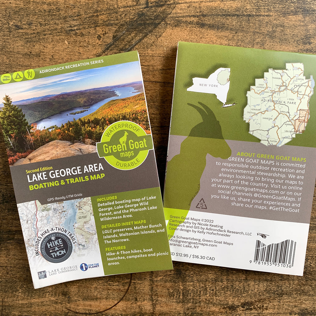
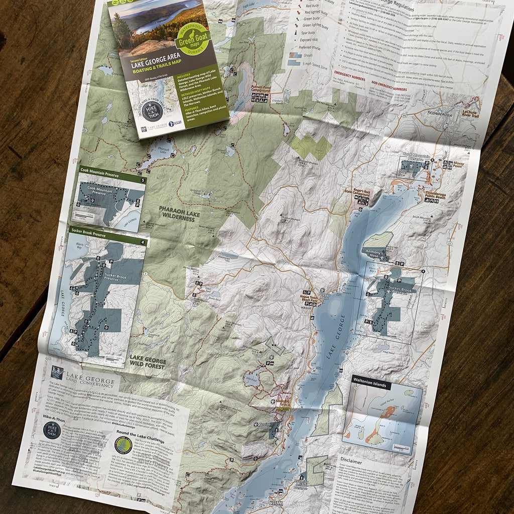
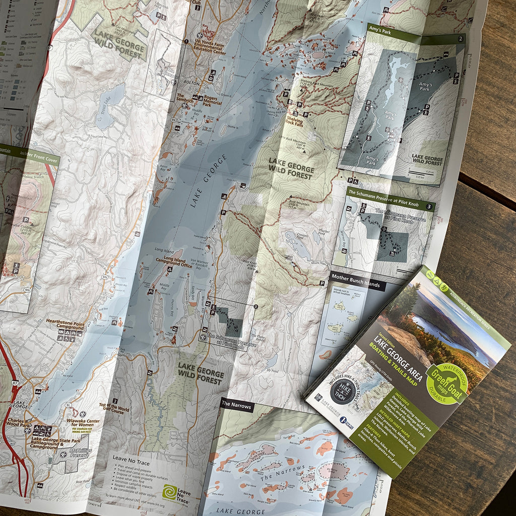
Lake George Area Boating & Trails Map, 2nd Edition
$ 12.95
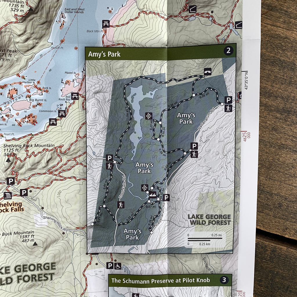
The second edition of this Lake George map by Green Goat Maps now includes Lake George Land Conservancy Hike-A-Thon sites and the Lake George Land Conservancy properties and trails that are open to the public. Like its predecessor, this maps features water depth, shoals, rocks, picnic areas, boat launches, and campsites. It also features insets of the Mother Bunch Islands, Waltonian Islands, and the Narrows and hiking trails and information for the Pharaoh Lake Wilderness.
All of Green Goat's maps have an ecological focus. This map highlights invasive species prevention and Leave No Trace principles. Green Goat Maps gives 1% back to nonprofits through 1% for the Planet.
Features:
- Boating and trails information for the Lake George, the Lake George Wild Forest and the Pharaoh Lake Wilderness Area
- Buoys, 5 mph speed limit zones, lake depth, campsites, and boat launches
- Lake George Land conservancy Hike-A-Thon Sites, Lake George Land Conservancy Land Classes
- Printed on waterproof HopSyn material. Durable and tear-resistant. Made in the USA.
- Map measures 18×24” unfolded, 4×6” folded